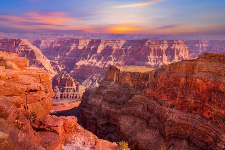
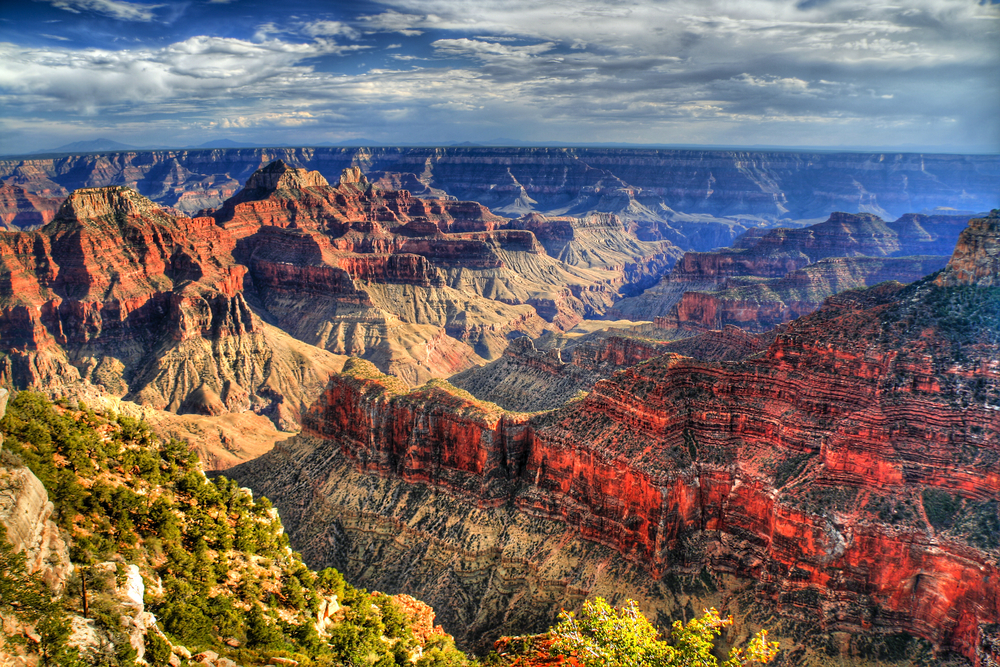
The Grand Canyon is one of the most stunning examples of erosion in the world. Currently a National Park, this vast formation is among the deepest canyons in the world. More than that, however, it’s a rarely-seen look into almost 2 billion years of geological history thanks to how it formed.
Let’s take a deeper look at the formation of the Grand Canyon and what we can learn from this enormous gouge on the surface of the Earth.
Initial Formation
Most people know that the Grand Canyon was seemingly formed through water erosion. Over time, water separates particles from the rock over which it flows and slowly cuts into the land. But the unique thing about the Grand Canyon isn’t that it was just cut by a river, there’s a more complex tale to tell about its creation.
The Grand Canyon’s story actually begins with an uplift, rather than a deepening gouge. The geological region is known as the Colorado Plateau. The area is now known for a lot of relatively odd geological features, being covered in things like hoodoos (tall, thin spires of rock), slot canyons, domes, and arches. The Grand Canyon is in the southwestern corner of the plateau.
Currently, it’s thought that the uplift began about 30-70 million years ago due to tectonic action. The Colorado Plateau is at the junction of several plates, and upon collision they began to rise.
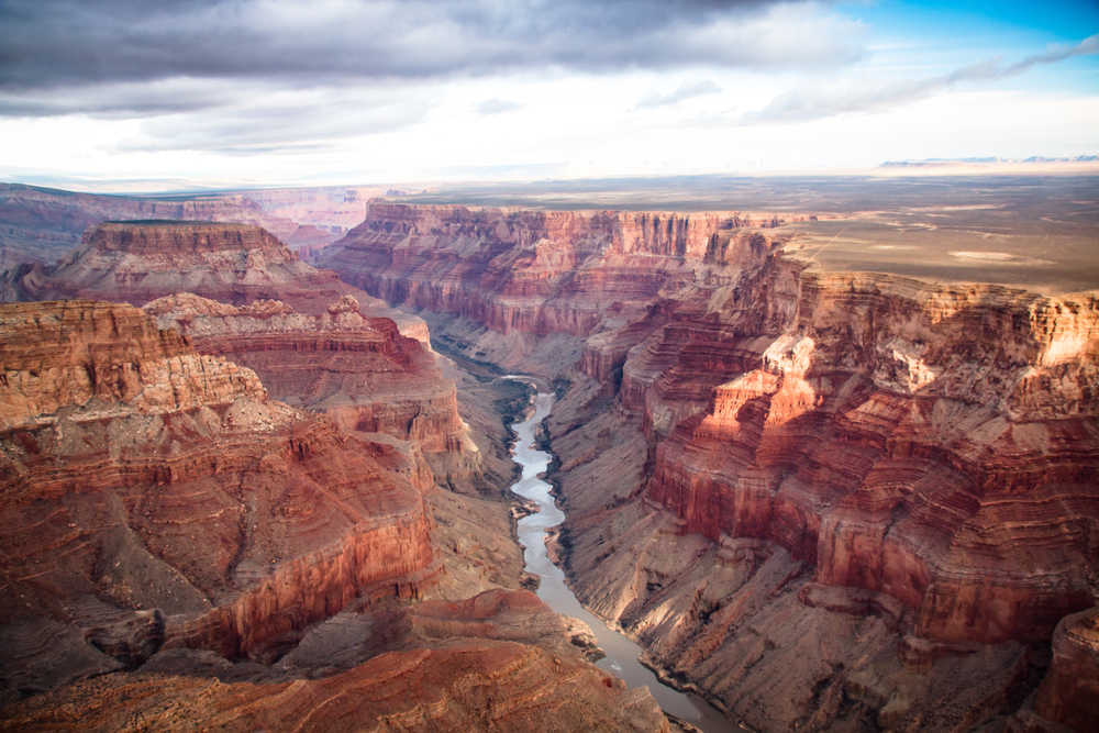
As the rock began to uplift in the area, the Colorado River began to take on its current course. To this day it runs through the center of the Grand Canyon, and over time it has exposed at least a dozen major layers of stone. It’s thought the current course of the river was settled roughly
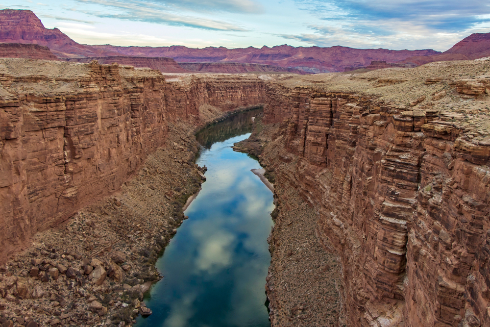
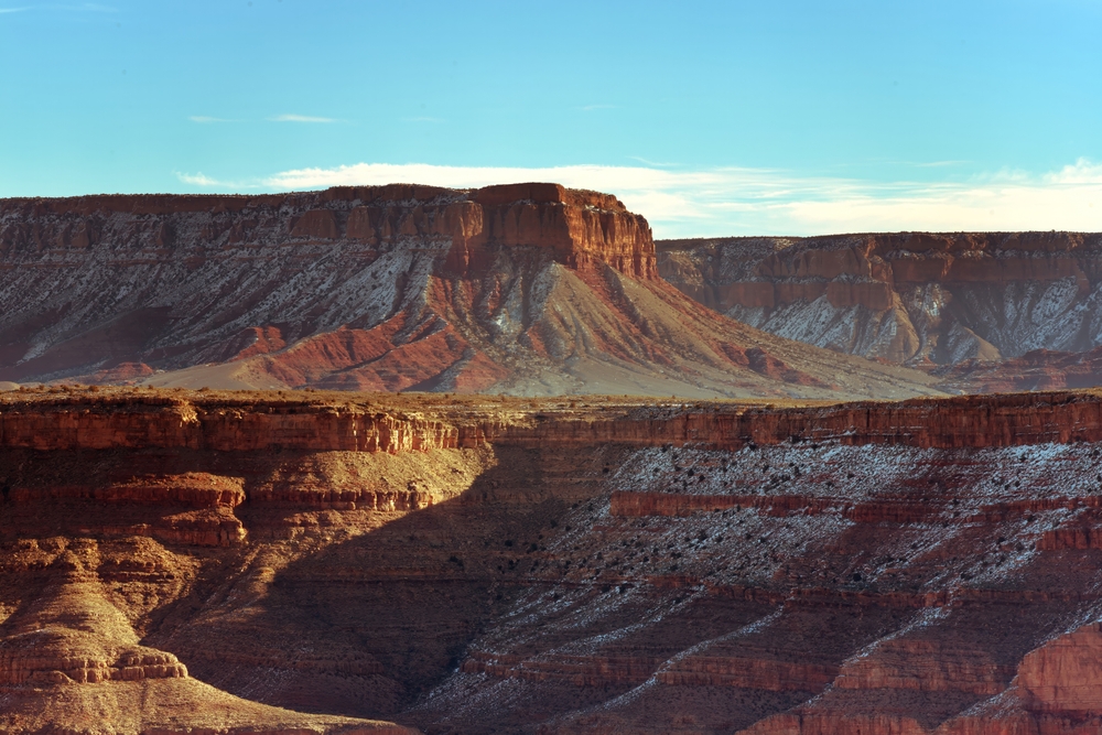
The result is spectacular. The Grand Canyon measures more than a mile deep in some places, while in others is only a few hundred feet. The width measures 10 miles wide at its widest point, the Toroweap Overlook, located at the North Rim of the canyon.
On the other hand, this width shortens to roughly 500 feet or so in other areas, such as Marble Canyon.
It’s kind of amazing that it all emerges from the running of a river over time. The Grand Canyon itself is the most famous example of water erosion although that’s not the only factor at play. It’s important to note that the height of the land around the Canyon itself also varies widely, with much of it being high desert.
In some areas, such as the aforementioned Toroweap Overlook, tourist sites are closed down during the winter because of snowfall and dangerous road conditions.
While impressive, it’s not actually the deepest canyon on the planet. Measuring canyons is notoriously difficult since many cut through mountainous regions rather than flat areas. This can cause inconsistent depth readings and leaves the matter open for debate.
That said, the Tsangpo Canyon in Tibet is roughly the same length as the Grand Canyon with some places showing a depth of over 18,000 feet.
The essential takeaway is this: the Grand Canyon was created through a combination of the uplifting of the Colorado Plateau and the continuous action of the Colorado River. In other words, the river cut into the stone while the stone was raising itself from the surface of the earth for a two-part action. The process continues to this day.
Horizontal Layer Placement
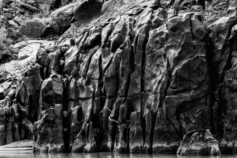
Unlike mountainous regions such as the Rockies, the Grand Canyon’s layers have been placed horizontally. Normally, during tectonic uplift we see twisting and deformation in the rock layers, forming mountains and other high features.
Meanwhile, the layers on the sides of the Grand Canyon primarily form into strict horizontal layers. This suggests the area was largely stable for much of its formation. There is still some minor twisting and deformation in some areas, but as a whole the layers are mostly stable and horizontally placed.
They’re visible in such great detail because the majority of the action that formed the canyon occurred through erosion rather than solely through deposition of sediments over time.
Continuing Erosion
The Colorado Plateau is still uplifting, and the Colorado River is still cutting into the depths of the canyon itself. Human action appears to have slowed many parts of erosion, however.
On a good year, the water volume passing through the Grand Canyon is roughly 10% of its original volume. This has caused erosion of low-lying features like sandbars, which were vital to the life inside of the Canyon. The main culprit in this case is the Glen Canyon Dam.
This shift in erosion has made the Grand Canyon a hotbed of activity for conservationists, who are still working on the problem. Proposed plans have included planned floods, but the latest of these had to be put on hold due to a regional drought that would have made it impossible for Glen Canyon Dam to release a flood while also still generating power.
Of course, rockslides and other wind-generated erosion play their part as well. Many areas of the canyon continue to widen as the supporting rock underneath fails and causes landslides.
While it may seem fairly static from our point of view, the Canyon itself is still constantly changing and is far from being an established “ancient” geological feature.
Layers in the Stone
The layers left behind on the sides of the Grand Canyon expose almost 2 billion years of geological history at this point. They’re formed almost exclusively of sedimentary rock, although the deepest layers are metamorphic rock.
The Vishnu Basement
The deepest layer of the canyon is known as the Vishnu Basement. This layer is mainly composed of different types of schist, and their appearance indicates they were most likely formed from submarine sedimentary stones.
There also appears to be younger, intrusive igneous rock spread throughout. The lack of deformation in these stones suggests they aren’t much younger than the estimated 1.75 billion years of age of the Vishnu Basement’s metamorphic stone.
While one would expect successive layers of metamorphic stone before sedimentary rocks are found, it turns out this isn’t the case.
The Great Unconformity
Instead, we have this ancient bedrock which is topped by sedimentary stone that’s estimated to be roughly 1.25 billion years in age. In some places, that group (called the Grand Canyon Supergroup) isn’t present at all, and instead, the stone’s next layer comes from the Tapeats Sandstone formation which is almost a billion years younger.
There’s no truly accepted theory as to the cause, but there are several theories that seem to fit the bill.
One of the most commonly seen theories is that at some point in the past, the Vishnu Basement emerged over the ancient seas of the region, eroding away above the water level. Over time, the landmass became submerged once more, allowing the deposition of sediments that would eventually form the further layers of the Grand Canyon.
The Grand Canyon Supergroup
In some places along the Great Unconformity, rocks representing the Unkar Group emerge. These are sedimentary rocks that overlie the Vishnu Basement in some areas. It doesn’t overly the entire Grand Canyon, however, and in various areas, it’s simply not present.
The layers contained in the Grand Canyon Supergroup are tilted at a roughly 10-15° angle compared to the layers of the Vishnu Basement, suggesting that it has been faulted in the past.
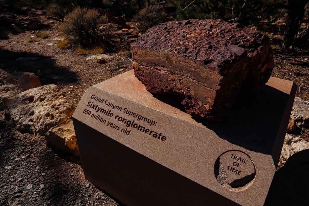
The Grand Canyon Supergroup is further broken down into four distinct layers. These are the Unkar Group at the deepest, followed by the Nanokweap Formation, Chuar Group, and Sixtymile Formation from bottom to top.
There’s an age gap of hundreds of millions of years here, further demonstrating how odd the Great Unconformity appears when compared to even the deepest layers of stone.
Cambrian Tonto Group
Above this region lies several layers of sedimentary rock, beginning with those from the Cambrian period. The Sixtymile Formation is often considered part of this group as well as the underlying Unkar Group. It consists of thin, bedded sandstone.
From these rocks, we’ve learned much about the history of the region. There are hints and traces of hundreds of millions of years of sediment deposition and its further transformation into rock under pressure.
At the bottom of these layers is the Tapeat Formation, a crisscrossed layer of sandstone. It’s thought to be a touch over a half billion years old and often emerges directly on top of the Vishnu Basement rocks.
Above this is a lighter-colored shale, often referred to as Bright Angel Shale. While the Tapeat Formation seems to lack anything but trace fossils, occasional fossils are found at the intersection of these two layers of sedimentary stone. It’s also attributed to the Cambrian Period.
Bright Angel Shale can often be seen as a slope-forming, greenish stone when you view the layers of the Grand Canyon from afar. In other places it’s closer to white, but it’s erosion often forms the slopes that occur before the more dramatic vertical cliffs that show up in the upper layers.
Above this lies two more successive layers of limestone. The Muav Limestone forms a light-colored layer above Bright Angel Shale. Here it’s sometimes broken into layers from the Frenchman Mountain Dolostone and is also intruded upon in places by the Temple Butte Formation.
Taken together, they show that the area was once a prehistoric sea, especially since most layers have some presence of fossilized marine invertebrates. The layers show different times when the land was covered by water, with marine sediment deposition forming the majority of the stones.
Redwall Limestone
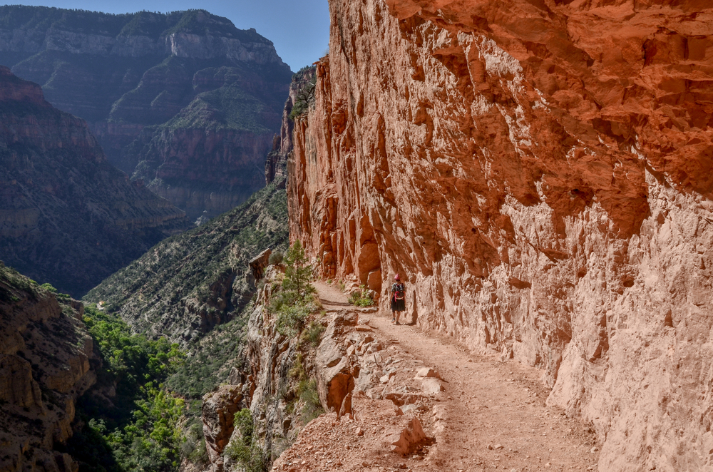
Above the Tonto Group is Redwall Limestone. This is a tougher, resistant sedimentary rock formation that often forms sheer cliffs along the sides of the canyon. It’s one of the most prominent of the layers, forming into dramatic cliffs.
The stone itself is described as a “cherty” limestone, meaning that it’s a sedimentary rock but has some characteristics of chert layers. Chert is a form of fine but relatively impure microcrystalline quartz. It holds together better than many sedimentary rocks over time.
The Redwall Limestone layer is intruded upon in places by both the Temple Butte Formation and the Suprise Canyon Formation. The latter is thought to have occurred after the filling of previous valleys left behind due to geological action when the Redwall Limestone was a surface stone layer.
The Supai Group
The next grouping of formations, from bottom to top, comes from the Supai Group.
This grouping was once considered a single layer but further study along the walls of the Grand Canyon resulted in a division of the formation into a group. The four groups are called the Wahatomigi Formation, the Manachka Formation, the Wescogame Formation, and the Esplanade Sandstone.
This group of stones is estimated to be 315 million years old.
The Supai Group is generally seen as sloping on the sides of the Grand Canyon, forming a secondary slope above the lower slope created by the Bright Angel Shale.
The Hermit Formation
Above the Supai Group lies the Hermit Formation. This formation is roughly 280 million years old, and in many places, it sits directly on top of the Redwall Limestone formation and represents another unconformity in the layers of the Grand Canyon.
It appears to have formed at the bottom of a shallow sea. This formation consists of reddish siltstone, mudstone, and fine-grained sandstone.
Because it lies on an unforming boundary, the Hermit Formation is one of the most important for understanding the past conditions in the area. It generally ranges from 300 to 900 feet in depth along the various areas it can be seen. In some areas, the layer may be as thin as 100 feet in depth.
In some areas, it appears that the stone was eroded to roughly 60 feet in depth, leaving behind remnants of ancient paleo-valleys.
Coconino Sandstone
The first of the lighter-colored layers of stone, and a prominent feature at the edges of the Grand Canyon, is known as Coconino Sandstone. If you’ve visited or seen pictures, you probably recall the portion of the canyon wall that emerges as a white cliff above the lower layers. This first layer of lighter-colored stone is Coconino Sandstone.
Unlike the lower layers of the Grand Canyon, it appears this layer of sedimentary rock emerged in an arid, desert environment. It varies widely in thickness, emerging as a 65-foot deep layer on the west side of the Canyon and deepening to as much as 600 feet in some places as you move Eastward.
This sandstone is primarily composed of grains of quartz, along with some smaller occurrences of feldspar in the stone itself.
The Toroweap Formation
The Toroweap Formation sits above Coconino Sandstone, showing a rich history of shallow seas and coastal areas that formed in the meantime. The formation is mainly comprised of gypsum and shales.
This formation is thought to be roughly 255 million years old.
Not as resistant as some of the lower layers, the Toroweap Formation often forms the highest slopes on the sides of the Grand Canyon. The most significant fact that the Toroweap has given up is simple: it shows the transition of the area from shallow seas to terrestrial as time went on and the sediments were deposited.
We’re almost to the top! The Toroweap Formation directly underlies the uppermost formation.
Kaibab Limestone
Kaibab Limestone currently forms the uppermost rock layer in the Grand Canyon.
This “limestone” is actually a very complex intermixture of different types of sedimentary stone. It’s the capstone of the Grand Canyon and is thought to be about 250 million years old. It’s what you’ll usually be standing on when you take a look into the canyon itself.
While it’s the top of the Grand Canyon, it also forms the lowermost visible layer of stone in Zion National Park. This alone showcases how important the Grand Canyon itself is for geological study, as the cutting action of the Colorado River has exposed an incredible depth of bedrock that could otherwise only be studied through more invasive means.
What We Can Learn From the Grand Canyon
The complexity of the layers of the Grand Canyon tells a long tale of the Earth’s history.
Of ancient, deep oceans and shallow, tropical seas. From the formation of dunes in an arid environment until the sea began to close over the area once more before receding a final time.
It’s hard to explain just how much information is there to the layperson, the subject itself can be the entire focus of a scientist’s career. Each layer shows valuable information about various time periods on our planet. The plunging canyon reaches down to show us almost 2 billion years of geological history, laid bare for those who know what to look for.
What we do know is that it shows that ancient conditions in the region varied from deep sea to arid plains, to sea once more. It’s a great study for those interested in the long history of our planet, and the Grand Canyon itself remains one of the greatest gifts ever given to geologists by nature.
It’s also one of the most studied geological curiosities in the world and a great way to showcase the immense history that lies hidden beneath our feet.